Wednesday, 25 September 2013

Sunday 18th August 2013. The Longest Day

Hiking day 4.  The Longest Day. 


Looking back towards the Canoe Centre hut. 

Looking back towards Amitsorsuaq and the Canoe Centre hut.
What a fine pair of athletes. 
I have to confess to feeling a bit disappointed about leaving the Canoe Centre this morning.  It would have been nice to have spent day there playing in the canoes on the lake and perhaps exploring some of the snow filled gullies which overlooked us. 
Looking towards the western edge of Amitsorsuaq

We began our days walk this morning in very good weather. It was dry and bright with some nice dramatic clouds to add a sense of drama to the landscape, as if it needed it.  The first half of today was quite easy going.  The route was either flat or tended to gently descend.  We followed the shoreline of the lake to a point at it's western end where a river flows out and down to another lake (Kangerluatsiarsuaq).  Ahead of us we could see the snow capped mountains of the Pingup range. Whilst the path generally descended it is also like a mini roller-coaster with plenty of undulations. As we neared the lake, Kangerluatsiarsuaq, the path goes over a small knuckle of land jutting out into the lake with a distinctly shaped, but not particularly high hill on top of it. From the top of this small hill we could look down to a stunning section of beach in the south western corner of the lake.  The beach formed a small sand bank which effectively created a small lagoon behind it. 
The beach and the lagoon.  And the first people we met going the other way. 
As walked down the steep descent to the beach we met a Danish couple who had camped at the beach the previous night. We stopped for lunch at the beach and were joined by a German couple who had come from Ikkattooq hut (our next destination).  They also thought the beach was a good spot for lunch.  This isolated beach was about to get even busier.  I sat on a small sand bank at the back of the beach and look to my right to see a reindeer walking along the shoreline towards us.  It didn't seem to be bothered by our presence at all and walked to within about twenty metres of us before veering away in a large arc around our position.   
On top of the first easy hill overlooking the beach
This morning's route had started off relatively easily but the last couple of kilometres before lunch were a bit more challenging and I was beginning to feel as if I was running on empty.   Lunch couldn't come too soon. 
Snow capped mountains to the north. 
From the beach the path heads west and away from the lake.  In places the path was hard to define so it paid to take our time to check our navigation.  Ahead of us lay three distinct hills marked on the map.  The first hill is relatively easy and not too high, but the next two hills involve several short but very steep climbs.  The ascent gets easier after a while and the top is littered with many small mountain lakes some of which had dried out over the summer leaving rusty red sandy scars on the ground. The route descended gently in to a valley filled with small interconnected lakes and pools.  At the head of the valley is a saddle of land which is essentially a small low ridge between two higher hills.  Right on top of this saddle is the Ikkattooq hut.  Someone had clearly noted what had been written in the in the Paddy Dillon guide which described the hut as having a "natural weathered-wood exterior" because someone had painted the hut in the traditional rusty red colour to match all the other mountain huts in this part of the world.    
Walking away from the beach. 
Looking back towards the beach.
Looking back towards lake Kangerluatsiarsuaq and the beach. 

On top of the rugged hills that overlook lake Kangerluatsiarsuaq
Looking back toward lake Kangerluatsiarsuaq
The hut is tidy but small sleeping only four people in comfort or six to seven people at a squeeze. When we arrived we found two Austrian chaps already settled into the hut.  So luckily we were able to bag the remaining two platforms. The Czech and German group arrived about 2 and a half hours after us so they had to sleep in their tents. However, they piled into the hut to cook their supper and to play their traditional game of rock, paper, scissors for chocolate. Again, much to our amusement.
I feel a bit of a psychological boost in knowing we have just completed the longest day of the trail. It certainly feels like an achievement and I am feeling very confident that we'll complete the hike successfully.  
The craggy tops above the lake. 

This terrain may not be particularly challenging when compared to places like North Wales or the Highlands in terms f high and exposed ridges, but unlike North Wales or the Highlands, if something goes wrong here you just can't call for help. There is no mountain rescue service.  You are not just a couple of miles away from a road where you could flag down a passing car.  You are in the middle of nowhere over a hundred miles above the Arctic Circle and if anything goes wrong, you have to deal with it yourself.  And regardless of what the guidebooks might say, the police really don't' want you to leave a route card with them.  They are NOT interested.   This is a sobering thought. Anyway, the longest day is done and tomorrow is another day.  


Early sighting of the Ikkattooq hut.
Ikkattooq hut
Inside Ikkattooq hut.  My bed is top left. 


The view west from Ikkattooq hut


Monday, 23 September 2013

Saturday 17th August. "The day that almost killed me".

Hike day 3.

The boulder strewn shoreline of lake Amitsorsuaq
We were beginning to develop a routine. Up early at about 6am, breakfast and on the trail by 8am at the latest.  We left the hut and our fellow Europeans at 8am and I swear I could hear their sighs of relief at the idea that they might get to enjoy a few hours of sleep without a soundtrack of snoring. As we collected our things together, I was sure there were a few grumpy looks from those poor souls who had slept below us.
The snore monster about to leave for the longest day. 
The morning started with drizzle and a blustery wind from the west.  The wind was so strong that it created some significant waves on the lake which would certainly have tested the stability of the canoes had we been lucky enough to have had one.  In fact,  we both agreed that canoeing into that headwind would have been hard and potentially dangerous work.  The canoes are renowned for their lack of sea worthiness.

The day's route stuck to the souther shoreline of the lake, Amitsorsuaq.  After about four or five kilometres the path begins to weave through an area strewn with huge, sharp and jagged boulders.  These forced us to focus on our footing and on our route finding. At several points the rocks force you to the very edge of the water.  The water is clear enough to see that the lake take a steep plunge only a short distance from the shoreline.  The rocks create numerous little rocky inlets and rock pools.  At one point we had to stop and survey a number of potential routes around and over a huge clump of boulders.  It was decided that to go over the boulders which were slippery and wet from the drizzle would be too dangerous.

We decided to attempt a traverse around the edge of the boulders.  This would involved us toeing our way around on a narrow ledge with our heels protruding into space over the lake.  This was high, it only a matter of a foot or two above the surface of the lake.  The problem was that a fall would almost certainly result in complete submersion and the potential loss of a pack.

Approaching the boulders on the shore of lake Amitsorsuaq
We agreed on a course and started to pick our way over the small boulders towards the big one we needed to traverse around.  Richard went ahead of me.  I stretched across a gap between two small boulders.  To my left were two or three other small boulders which formed an almost triangular shaped inlet filled with water.  The size of this inlet was about half the size of a standard bath tub.  As my weight went forward, the mud beneath my boot which also covered the top of the rock I had just transferred my weight to, gave way.  The entire event happened in slow motion and I remember exactly what went through my head at the time.  I felt the weight of my pack pull me back and twist me so that I faced the shoreline with my back towards the lake and the little inlet, which had been behind and to my left, but which now was just straight behind me. I knew that I was too far from the edge of the lake to go into really deep water but the thought going through my head was that I was falling backwards and I was going to smash my head on the rocks. I put my arms out to the sides in the vain hope of being able to grab something.  Instead as I fell I whacked my left elbow on a rock.  I closed my eyes in anticipation for the inevitable crack to my head.

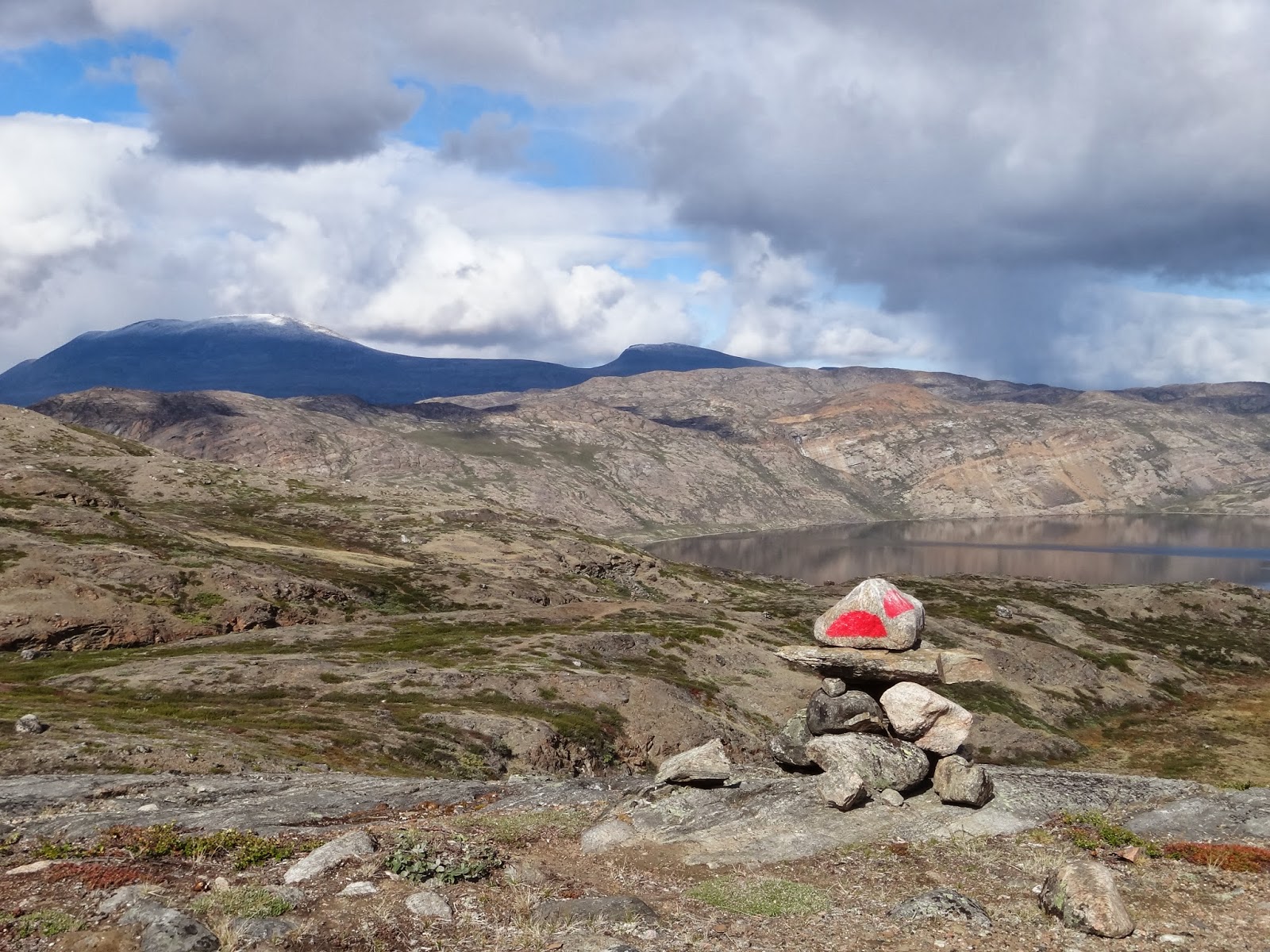
A cairn overlooking Aitsorsuaq
Shoreline of Amitsorsuaq
I opened my eyes.  I was aware of pain in my elbow and I immediately thought the worse and feared that I had broken it. I had come to rest on my back with my legs sticking unceremoniously into the air.  My pack had got wedged in the triangular inlet.  The pack itself was just under water so that my back lay in cold water and my legs were sticking out and pointing up the bank.  My pack still weighed in at about 30 kilos so getting out of this wedged position unaided was going to be pretty tricky.  Luckily, there was the snore horse himself.  Richard sprang into action with the campiest exclamation of "oh Jonathan!!"  He quickly grabbed hold of the shoulder straps of my pack which prevented me from slipping into the water any further.  I had to fold my legs back and put them into the lake until I found some footing that I could push against in order to extricate myself, with Richard's help, from the icy water.  By the time my feet found purchase I was up to my waist in water.  With a heave from Richard I was out and sat on a rock.  My pack was off and I was checking myself and my pack over for damage.  I could not believe that I hadn't cracked my head open on the rocks, but perhaps the size of my pack had worked in my favour and provided a measure of protection from the impact. The only damage was a small hole in the elbow of my waterproof jacket and small bleeding hole in my elbow. Once my elbow had received a plaster from the first aid kit, we surveyed an alternative route across the boulders.  The next 30 minutes were spent negotiating our way over more slippery sharply jagged boulders.  We took our time.
 
The profile of face in the rocks overlooking
lake Amitsorsuaq
The path continued to monotonously follow the shoreline of the lake.  The weather was not getting any better.  The wind was getting stronger and colder and there was the ever present risk of rain, sleet or snow.  The weather dictated our pace and our destination.  We had considered pressing on beyond the next hut, but we decided to be sensible and chose to head for the hut known as the "canoe centre".

The "canoe centre" is the largest of the mountain huts on the trail and it's a bit of an anomaly.  There it is in the middle of nowhere.  There are no roads or tracks to it, yet it is a substantial hut with two dormitories, a large kitchen area and two chemical toilets. There are also a number of old battered aluminium canoes in various states of repair together some of the roughest improvised paddles I have ever seen.  Regardless of the state of the canoes, this hut is a credit to those who maintain Arctic Circle Trail.

The profile of face in the rocks overlooking
lake Amitsorsuaq
We arrived at the "Canoe Centre" at about 4.15pm.  The hills surrounding the hut were still sporting patches of last winter's snow. We immediately set about our chores.  I collected water from the lake, Richard put the kettle on and I set up one of the toilets with the obligatory black plastic bag and then proceeded to half fill it with matter.  I then had a strip wash down by the edge of the lake.  The water was refreshing and breathtakingly cold, but I felt cleaner.  Feeling clean on a trail is important for morale and for hygiene and with water this cold, it's invigorating too.  

Looking back along the lake
Our friends the Czechs and the German arrived at the "Canoe Centre" at about 6.15pm tiered but in good spirits. We exchanged "hellos" and a few comments about the day, and then kept ourselves to ourselves.  I think they were very pleased that the hut was big enough to escape the snoring.  They sat at the kitchen table at played Rock, Paper, Scissors for pieces of chocolate and Harribo, much to our amusement.
Reindeer antlers and Amitsorsuaq

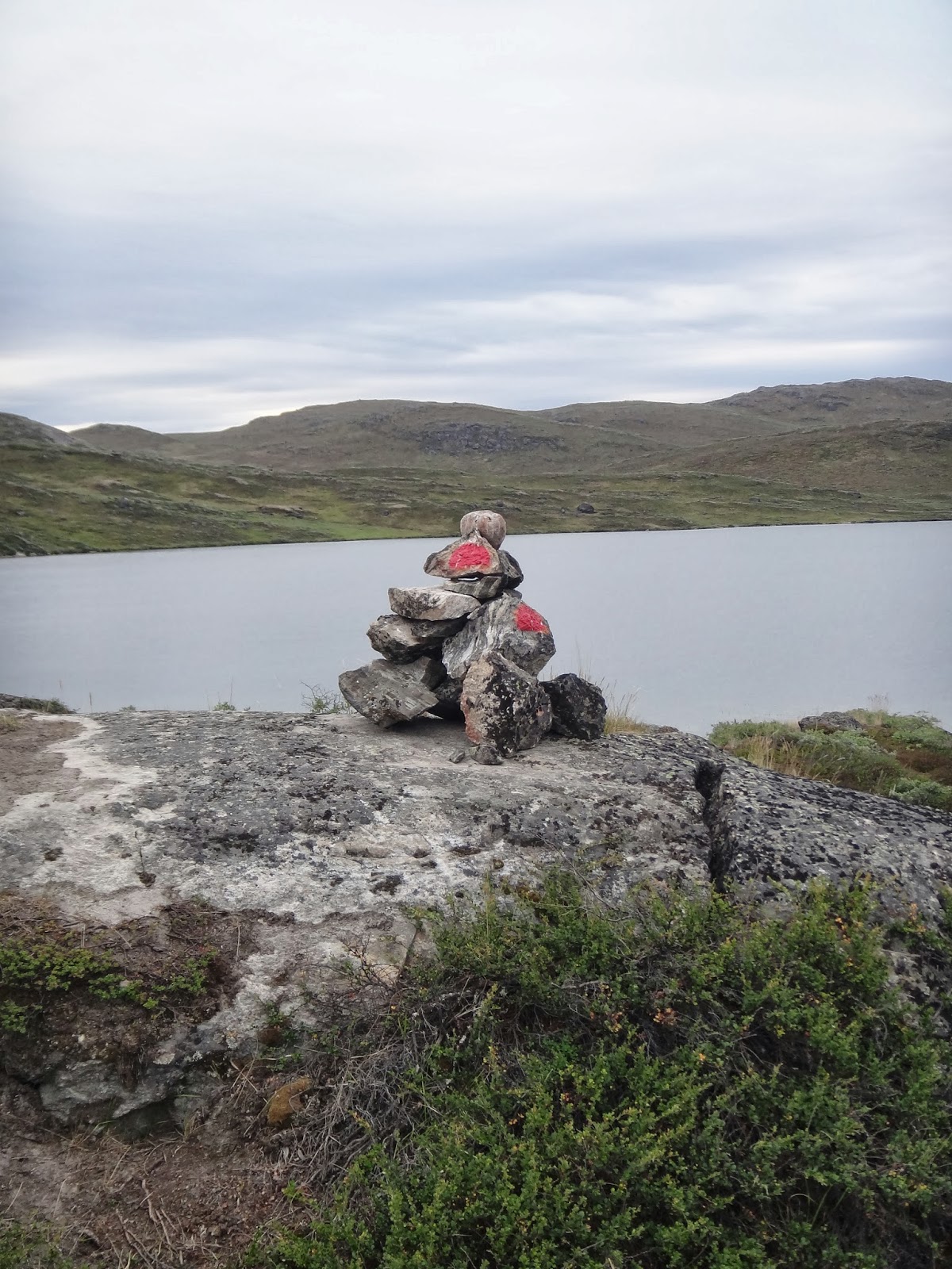
A distinct cairn.  We did leave it standing. 
Tomorrow is the longest day so I must sleep soon.  Today was hard enough.  I feel battered and bruised. My feet feel utterly pummelled from hour after hour of scrambling over boulders in wet boots, my back, legs and shoulders ached.  I will sleep well tonight.

Tomorrow we need to cover 22km and it will be a psychological boost to know that the longest day is behind us. However, we also need to climb a relatively big hill which we should come to after about 13km of hiking, just when tomorrow's fatigue will be setting in. The hut at the end of tomorrow's route is described as small so if we can't get a space on the sleeping platform, we'll have to rely on our cold damp tents for shelter. Tomorrow, we head for Ikkattooq, a 22km slog.  At least the day after tomorrow is a relatively easy 11km (the shortest day).    


The Canoe Centre

The Canoe Centre hut

Canoe Centre hut with snow patch on the hill behind. 

Some of the battered canoes at the head of the lake. 
             

Friday 16th August, Day 2: Strip wash

The day started with a strip wash.

Farewell to the caravan. 
Caravan viewed from the lake edge. 
The day started with a strip wash in the lake at about 7am. The water was no where near as cold as I imagined it would be.  This must have been the impact of all the warm weather Greenland had been experiencing.  The water wasn't warm enough for a relaxing soak, but it was warm enough for a refreshing dip without stealing one's breath.  Following our morning ablutions, we surveyed the map. The entire route is covered by three maps and there was a certain psychological boost to be had from crossing from one map to the next.  Route finding was pretty straight forward.  We skirted around the lake, climbed a small hill, dropped down and followed another lake. Whilst the navigation was straight forward, the route was undulating and, at times, exhausting.  At one point the path becomes very narrow with plenty of ups and downs traversing the edge of a steep sided lake. A stumble would definitely lead to a swim.  Three reindeer were sighted today which was nice, but unfortunately, the weather was beginning to deteriorate. It rained for most of the day.  At about the half way point for the day, the route dropped down to a boggy area of land between two distinctly shaped but not particularly high hills. the boggy ground is all that separates two lakes.  This flat area of bog between two hills is dissected by a narrow channel which is wide enough and deep enough to make the removal of boots and the donning of crocks a necessity. 
The flat boggy ground between the two hills.  First (small) river crossing.

The second of the two hills is actually a promontory jutting out from the bank on the opposite side of the lake. Once crossed we paused for a few minuted to take on some calories.  Once the ford had been crossed and we had eaten, we set off once again with the path climbing again providing fantastic views of where we had come from and of the more rugged mountains to the north.  
Cairn decorated with a scull. 

A distinct cairn 
One of the many cairns marking the route. 


After about four kilometres the path began to descend again to the southern shoreline of another lake.  The rising landscape to the left of us obscured the view of the next hut for some time.  As the route turned slightly to the right around the base of a small headland, the next hut, Katiffik came into view.  I for one was hoping to see a canoe parked up at Katiffik hut.  The hut is located at the eastern end of Amitsorsuaq lake.  

Just one of the views. 
At the far western end of the lake is the next hut referred to as the 'canoe centre'.  If one is lucky, hikers doing the Sisimiut to Kangelussuaq route will take advantage of one of the battered aluminium canoes and paddle the length of the lake leaving the boat for other hikers to use from Katiffik.  Sadly, if a canoe had been left at Katiffik, then who ever had reached the hut before us had used it to paddled back to the "Canoe Centre".  Katiffik hut is rather dark and small.  There is just the one little window so natural light is at a premium.  There is a small cooking area and a sleeping platform with enough room for three people on top and three below.  Small and dark it might have been, but it was dry.  We hung up our damp things, made some supper and started to read our books.  
The remains of reindeer 

About to set off from Katiffik 
After about an hour, the silence was disturbed by a group of university students consisting of four Czechs and a German (two boys and three girls). All, apart for one, were PhD students and the exception was studying for a masters degree. They were clearly bright and their command of the English language put our command of any foreign language to shame. The weather had deteriorated further and they had got caught out and one of the girls had slipped up to her waist in to one of the lakes.  They were all cold, tiered and wet.  We made as much room for them as possible and with typical English reserve, tried to stay out of their way as much as we could so they could sort themselves out. As night fell, a couple of the students had retired to sleep in their tent.  Little did they know how lucky they were. The floor of the hut became a mass of sleeping bags, packs and bodies.  The night was not a quiet one.  Richard's snoring was of earthquake inducing proportions. I was beginning to get use to it... sort of.  Those in the tent had the best nights sleep out of all of us. 

Richard and me by one of the many cairns with their distinct red semicircle 


Especially for Daryl; some Arctic fox poo. 
Katiffik hut and the lake 


Early sighting of the hut at Katiffik
The hut. 

A blurry picture of one of the many reindeer spotted.


Sculls of reindeer and a lake. 
Another blurry picture of another reindeer.  David Attenburgh has nothing to fear.