Hike day 5: a lovely day.
 |
| Looking back towards the hut at Ikkattooq |
The two Austrian guys were the first to get up this morning. They didn't look too please as Richard's snoring had been of epic proportions last night. We all moved around each other preparing breakfast and organising our packs. We won some brownie points from the Austrians because it transpired that they were in danger of running out of stove fuel so we were able to boil up some water for them for which they were very grateful.
After breakfast, the Austrians were the first to leave the comfort of the mountain hut. I had to treat my feet as the soaking they had received in the lake a couple of days ago was beginning to make my feet rot and I was beginning to shed skin. After everything was organised and feet had been dusted with powder, we left the hut about 50 minutes after the Austrians.
It was only when we stepped outside the hut to leave that I noticed that it was anchored to the ground with steel cables to prevent it from blowing off the ridge in high high winds.
 |
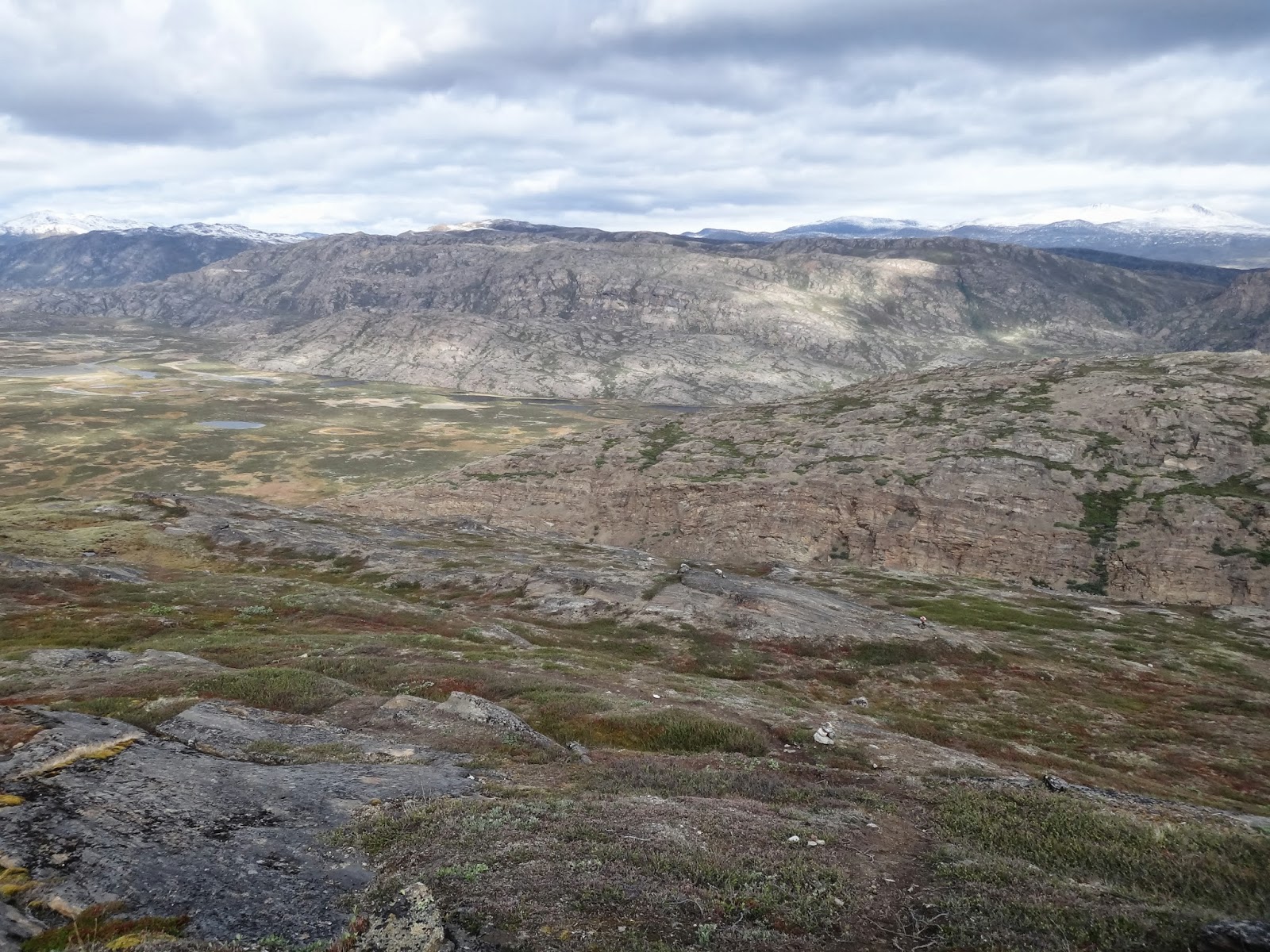
| The hill top cairns with snow capped mountains to the north. |
Although the hut is already high in the mountains the route starts with a steep ascent and then flattens off as it passes a number of small mountain lakes and pools. On the way up we stopped to take in the view of the hut and the tents against the enormous background.
At the top of this ascent we stopped and took in the view. We have been hiking for five days and yet when we look back to where we have come from we could just make out the glacier beyond the unseen Kangerlussuaq. We continued along the tops with the path undulating and switching from tufty grass to bare rock and hardened mud flows. After a couple of kilometres the view opens out over the vast flat bottomed valley called Ole's Lakseelv. We could also see the snow capped mountains of Pingup Sallia and Pingu to the north. From here the path descended steeply over boggy patches and boulders. On our descent we caught our first sighting of an Arctic Hare. It looked more like a rabbit than a hare with the exception of being white. On reaching the valley floor which barely sits above sea level we saw a female reindeer with a calf. As seems to be normal with deer, they watched us for a while with some curiosity before running away for a few seconds before stopping to check us out again. No wonder they are easy to shoot. The poor things are just too damn curious.
 |
Looking back to where we started.
The glacier is just visible in the distance. |
 |
| Looking down in to the flat bottomed valley of Ole's Lakseelv |
We headed for a point on the valley floor marked on the map as a ford. This is one of the recommended spots for making the crossing across the river that flows through the valley. The going was relatively easy although forcing our way through dwarf willow was becoming a bit tedious. On our way to the river crossing we came across two Danish guys, a farther and son team we thought unless they just had a very uncanny resemblance to each other. They informed us that the next mountain hut had no fresh water close by as one of the mountain streams that had flowed conveniently close to the hut had dried up as a result of a hydroelectric scheme some miles up stream.
We pressed on and when we reached the river we met the two Austrians again who had just completed their river crossing. We exchanged hellos and they headed off.
 |
| The walls of the valley of Ole's Lakseelv |
We surveyed the river for a suitable place to cross. There is, according to the guidebook a small wooden foot bridge about two kilometres down stream. However, this seems to be a bit of crazy country planning as no one seems to use it. Everyone we met and spoke to had headed straight for the ford.
 |
| Richard half way through the river crossing. |
 |
| Me crossing the river. |
 |
| Cotton Grass on the valley floor. |
We have both trained as Mountain Leaders so we practiced what we preach and employed good safe practice when crossing the river. We removed boots, socks and as I didn't have zip off bottoms to my trousers, I removed my trousers too. We both donned our crocs, undid the waist belts on our packs and slackened off the shoulder straps. We crossed individually using our walking poles for additional support. The water was cold. It had flowed out of a huge lake a few hundred metres away from us and it teemed with small fish. Only a few days ago this water rushing past my feet was probably ice.
Once across the river we dried our feet and collected about four litres of water each to carry to the hut. This added another four kilograms to our still heavy packs.
The path from the river took us through some large patches of boggy ground with large clumps of what I think is called Cotton Grass or Bog Cotton due to its fluffy white flower heads. The flies started to be a nuisance along this stretch of the trail. We knew they could be a problem but we had not experienced any problems with flies, mozzies or midges up to this point. The "bog flies" didn't seem to bit but their irritation come from the fact that they can't seem to help flying into your ears, nose and eyes. For the first time I donned my head net and applied some insect repellent. The repellent didn't seem to work so I can recommend having a head net if you are thinking of doing this hike.
 |
| Cotton Grass (Bog Cotton) on the valley floor. |
We followed the northern edge of the valley floor which took us through bogs, dried up lake beds and dried up stream beds which offered lots of interesting animal tracks. After about two kilometres the route starts to ascend a gentle gradient which runs up the side of a bigger spur. The path bends round the right and take you over a low shoulder of the spur where, quite suddenly, the hut comes into view.
The hut is very tidy and appears to be quite spacious with a toilet. However, the space isn't particularly well organised as the sleeping platform only provides space enough for four people. The view from the front door of the hut is simply breath taking and photography just doesn't do it justice.
Today was another one of those days where you have a little psychological milestone because we passed the halfway point today. Only 82km to go. So far, I am loving this experience. The sense of isolation and remoteness is profound.
 |
| First sighting of the Eqalugaarniarfik hut. |
On arriving at the hut we were a bit surprised not to see the two Austrian guys. They had clearly decided to push on a bit further before settling down for the night. We had been at the hut for about 3 hours when the Czech and German group turned up. With plenty of floor space everyone was able to find somewhere to sleep. Tomorrow is another longish day (20km) with a steep ascent early on and the potential for some tricky navigation around lakes, streams and bogs.
 |
| The Eqalugaarniarfik hut set against the mountain. |
 |
| The view from the Eqalugaarniarfik hut. |
 |
| The sun still high in the sky at 9pm. |
 |
View from the Eqalugaarniarfik hut
with our flag fluttering.. |
 |
| Supper at the Eqalugaarniarfik hut. |
 |
| Supper at the Eqalugaarniarfik hut. |
 |
| The sun getting lower over Ole's Lakseelv. As seen from the hut. |
 |
| View from the hut. |


No comments:
Post a Comment